Hythe to Folkestone - One of the Guardians 10 great coastal walks pt 2
In August 2020 the Guardian published an article listing 10 great coastal walks including a walk along the Royal Military Canal & the sea front to Folkestone. The little yellow cottage is roughly in the middle of the walk in Sandgate. The original is a good walk but if you are setting out from Sandgate it makes so much more sense to split into two circular walks. Although these are still basically coastal walks in this the second of the two walks a change to the route and go inland on the outward journey before heading back along the coast adds to the interest. We follow and old sisused rail line, we find a castle, the famous ossary at st Lenards & a working fishing beach with fresh fish for sale.
When you step out towards Hythe along the sea wall you will go past the backs of some of the splendid old houses many now with beautiful modern extensions among them a large blue Victorian home which was the childhood home of Hattie Jacques a comedy actress forgotten but for the aged fans of “Carry On” movies. The last house before you get onto the Sandgate Esplanade was the Coastguard station.
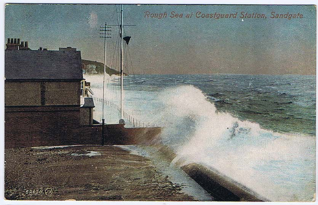
Fig 1. Postcard of the Sandgate Coastguard Station aprox 1908
Before the modern coastal defences were established in a good storm the waves would regularly overtop the house & flood the road.
Just a hundred metres on from here on the right-hand side is Encombe. The mushroom house on the right-hand side was originally the gate house to the home of Ralph Hylton Philison and his wife Maya. Later I will suggest a short circular walk above and through the Encombe estate. You can find out a little more about this glamorous and wealthy couple here http://thelondondead.blogspot.co.uk/2013/11/philipson-mausoleum-golders-green_7.html
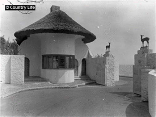
Figure2 Encombe Gate House 1924
You can see an archive of photos of Encombe the Encombe Estate on The Sandgate Society Archive http://archive.sandgatesociety.com/19
Shortly after the Esplanade there is a paved path called Brewers Hill home to the Earl of Clarendon pub. At the top of Brewers Hill there are paths that take you up into Shorncliffe camp – what remains after most being sold off by the MOD is home to the Gurkhas. There is small path leading to the Corniche & Hospital Hill which was the first military base hospital on return from WW1 & 2.
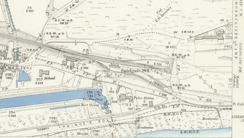
Figure 3. OS Map from 1896 showing Sandgate Station & the start of the Royal Military Canal
As you walk further on the sea front towards Hythe on the right-hand side you will walk past several large and imposing homes. Residents along Sandgate Esplanade in 1875 included Lord & Lady Pelham (Earl & Countess Chichester), Hon. Lady Bligh, Lord Russell plus four Majors, three Colonels, three Captains, a Lieutenant, and a retired General. The latter senior officers from Shorncliffe camp.
If you are interested in who once lived along this stretch check out this blog from the Sandgate Society https://sandgatesociety.com/sandgates-hidden-history/
At the end of this stretch of the walk you will see the huge stone wall with an estate of modern houses on it. This is Battery point. Originally built as part of the fortifications overlooking the extreme end of the Royal Military Canal – it was from the mid-19th century the home of Sandgate railway station the end of the short branch line from Sandling Junction. The line never paid for itself and was abandoned in 1931. If you continue to walk along the main road to Horn Street you can see the remains of the railway bridge. http://www.disused-stations.org.uk/s/sandgate/
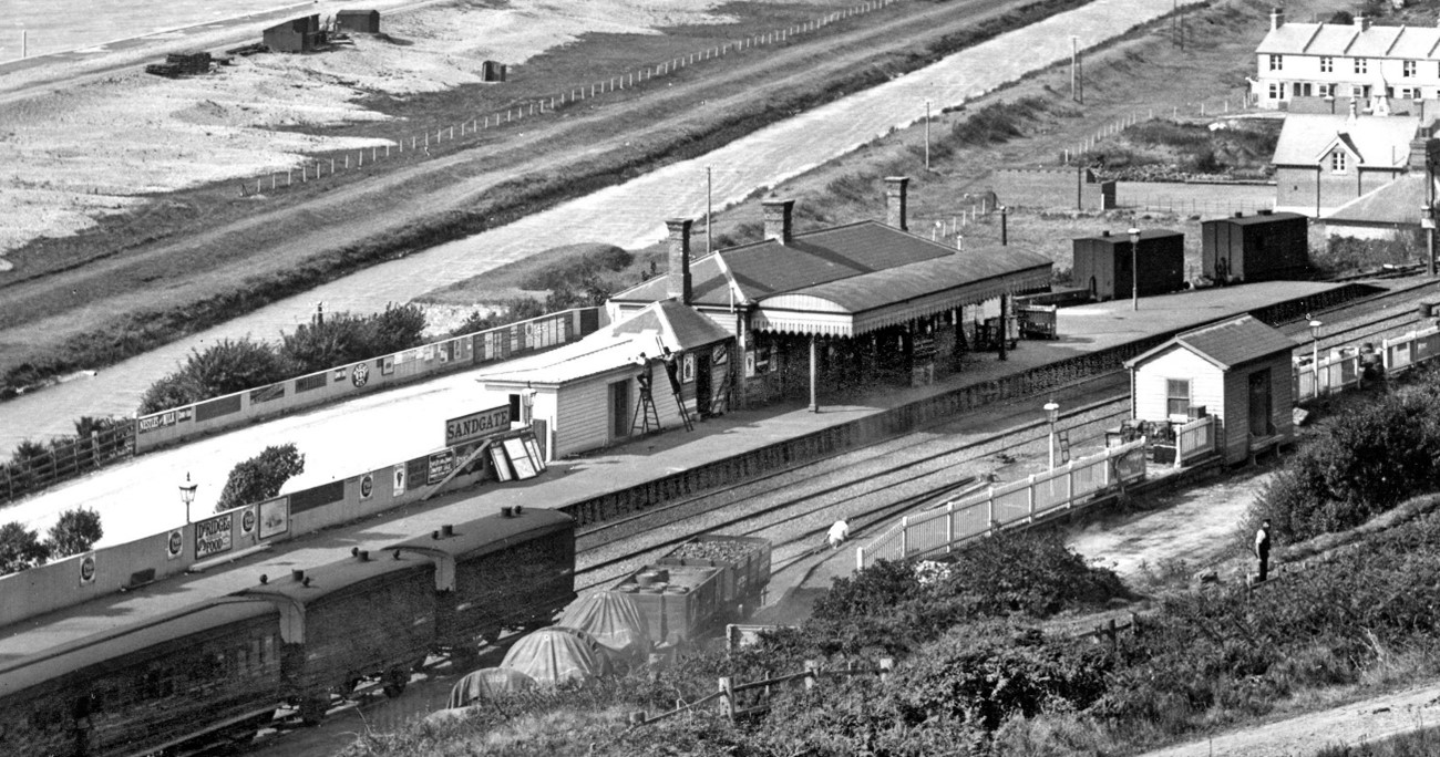
Figure4 Sandgate Railway Station - branch line from Sandling Junction
As the coast road splits in two take the fork away from the sea & within a few hundred metre you have reached the start of the Royal Military Canal. The canal was originally built as part of the channel defences against Napoleon. Work commenced in 1804 and the 28 mile canal cutting through the back of the Romney Marshes was completed 5 years later. The canal is now a haven of tranquillity for walkers, anglers and naturalists. It is both a site of special scientific interest and a scheduled historic monument. The canal only had 2 purposes one as a primary drain for the Romney Marshes, & as a defensive line in case of invasion.
At the first foot bridge you arrive at turn right towards the main road. Cross the main road and in front of you is a private road. This is Cliff Road. After a short uphill section you come to an estate of new houses on right hand side. These are built on the Sandgate branch line.
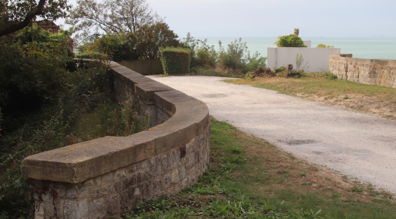
Figure 5 Sandgate branch line Cliff Road bridge
Just pass the houses is a surviving bridge crossing the line. From here you start to see the views across onto West Hythe, the extensive rifle ranges & the Romney Marshes. The road now goes straight and the houses on the left are all built in the embankment of the branch line. As a child this old branch line was an overgrown wood and our playground.

Figure 6New build houses on the Sandgate Branch line
There are couple of paths and bridleways going off to the right that will take you onto the golf course beyond. The last of these goes through Sene Park housing estate & onto the Elham Valley Way. There has been a golf course there for well over a century.
Dress Code in the 1890s – Men to appear on the course attired in gaiters. heavy woollen socks, knee breeches, red coat with brass buttons and deer stalker hat. The ladies attire is a red hip length coat with white lapels, long black dress and straw boater with a band in club colours. Visitors Guide to Folkestone 1937. The Hythe Golf Club (Sene Valley) a Course of 18 holes is close to Hythe Station. Visitors (either ladies or gentlemen), introduced by members, 3s 6d per round. 5s Saturdays and Sundays; 25s a week; 60s a month. Sunday play with caddies. On Saturdays and Sundays between 9:30 and 11:00 a.m. ladies must not play without the Secretaries Permission.
At this point keep straight on. Just before you get to the end of the road there is a little road called Cliff Close this is built on the site of the railway station for Hythe, and from here there was a tram service that went into Hythe and along the front to Sandgate.
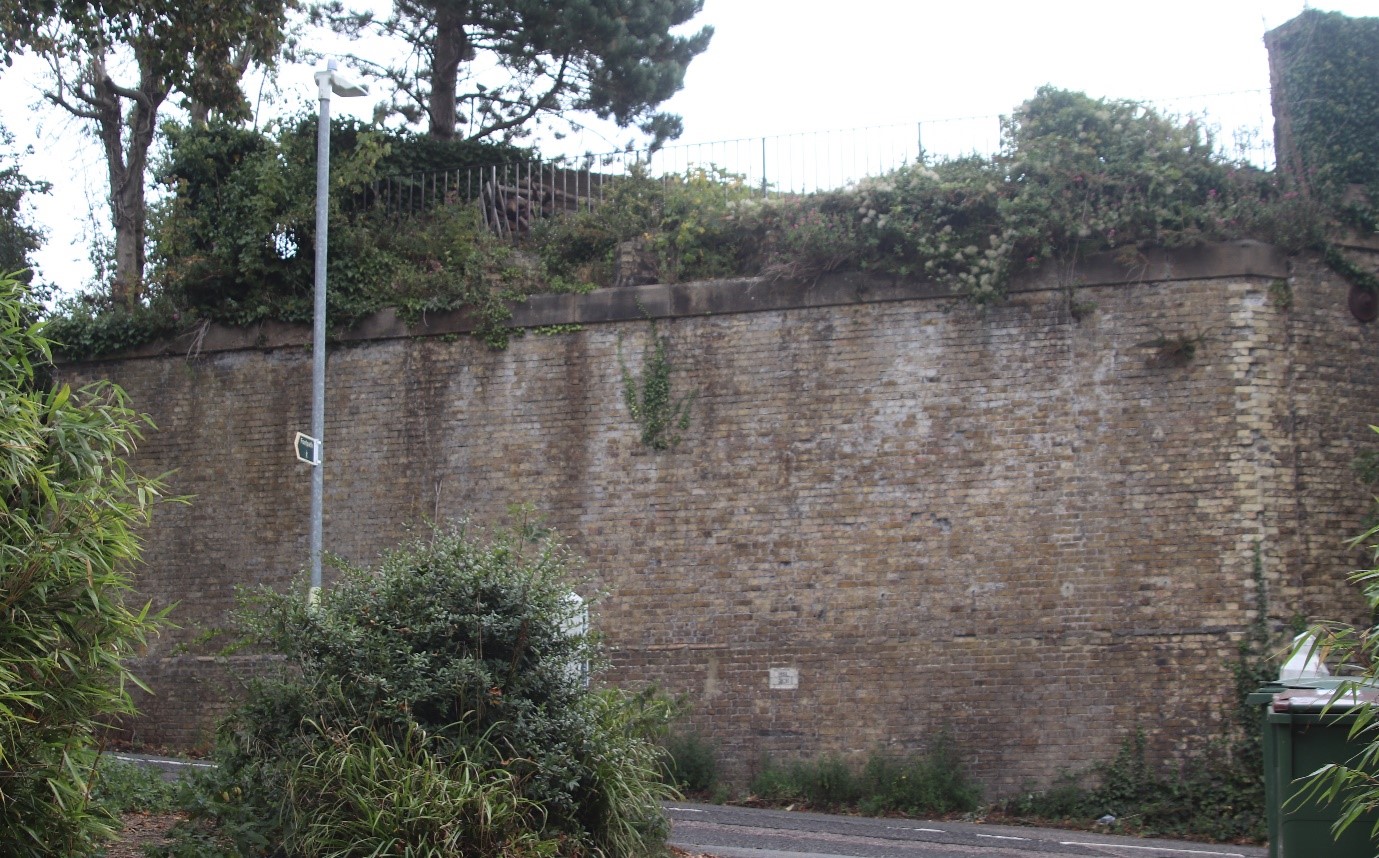
Figure 7 The remains of Sandgate Branch Line Bridge over Blackhouse Hill Hythe.
Reaching Blackhouse Hill cross the road & turn downhill. The stone walls on the far side are the remnants of another railway bridge. You can see its reference number on a wall plaque. Few metres down there is a path looks a bit like a driveway doubling back a bit. Follow this and it will take you into a field. On your righthand side is a line of trees, following the old railway line. On the left at the bottom of the valley is a stream that runs down to a Water Mill & finally feeds into the Royal Military Canal. The Mill is now converted into a great looking house.
At the far corner of the field cross the stream, on your right will be another of the remaining rail bridges. In front of you the path takes you around the ramparts of Saltwood Castle. The Castle is now the home of Jane Clark widow of the colourful Tory MP Alan Clark.
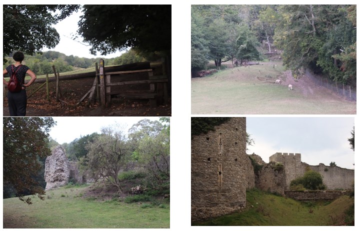
Figure 8 Walk across the fields from Blackhouse Hill To Saltwood Castle
Saltwood Castle is rarely open to the public in any way. The Castle in its present form has been there since the 12th Century & is most famous as the place from where 4 knights set off to murder Sir Thomas Beckett on behalf of Henry 2nd. “Who will rid me of this turbulent priest.”
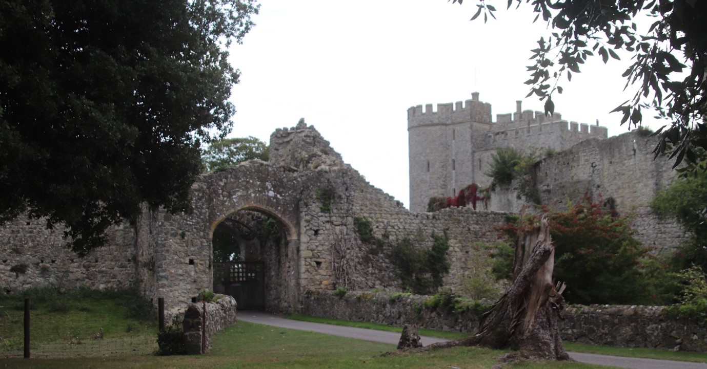
Figure 9 The gatehouse & keep at Saltwood Castle
Now taking Grange Road with the farm on your right you will reach Saltwood Village Green. For basic pub food & drinks The Castle Pub on the green is OK. If you want fine dining then just off the green is The Hide & Fox ( https://hideandfox.co.uk/ ). You will need to book if you want to include this on your walk and at £55 per head plus this will be a real treat.
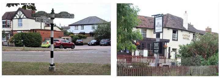
Figure 10 Saltwood Green & the Castle Hotel
Cross the green and head down Brockhill Road. A short distance up the road on the left hand side you will come across a wide grassed road that is part of the historic castle lands and heads towards Eaton lands. Follow the grass road onto Lookers Lane & turn left at the end down Castle Road.

Figure 11 Eaton lands history board
Follow Castle Road to the end you will go past Eaton Land allotments on the left. Eaton Land was originally common land linked to the castle. At the end of the road follow the steep path down onto North Road. This will bring you out just above St Leonards Church. The church has a fascinating history from the outside you can see its Saxon & Norman towers. It is famous for its ossuary. It is claimed to be the largest collection of ancient human skulls & bones in Britain. There are a number of theories as to why the remains came to be here. The simplest is that some were dug up when the church was extended in the 13th century, and or they were the accumulated remains from a number of cemeteries that became disused by the 15th century. https://www.slhk.org/theossuary.htm
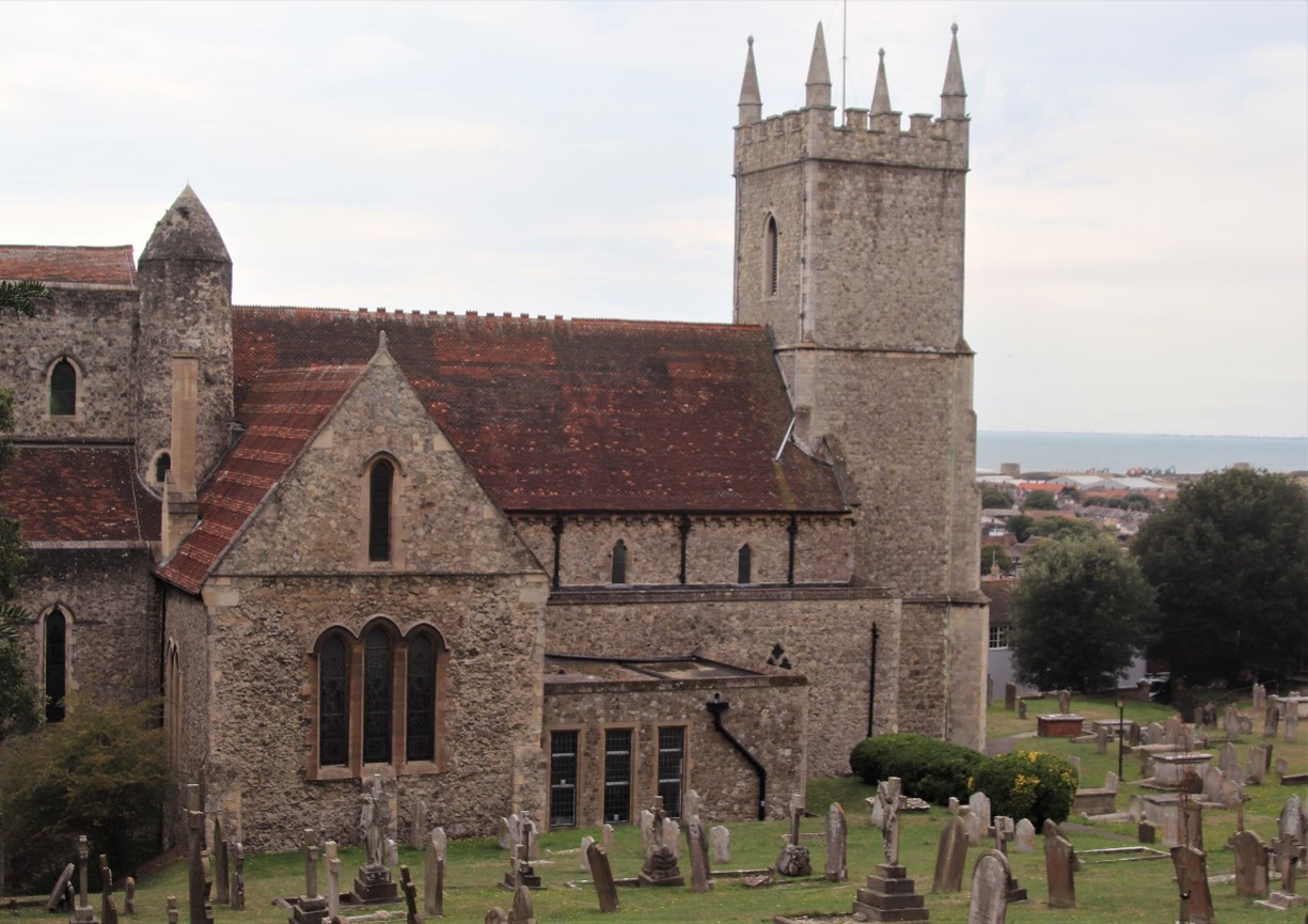
Figure 12 St Leonards Hythe Parish church with saxon & norman towers
Return to the path alongside the cemetery & descend towards the High Street. As you reach the bottom of the path on the right-hand side is reputedly the oldest building in Hythe.
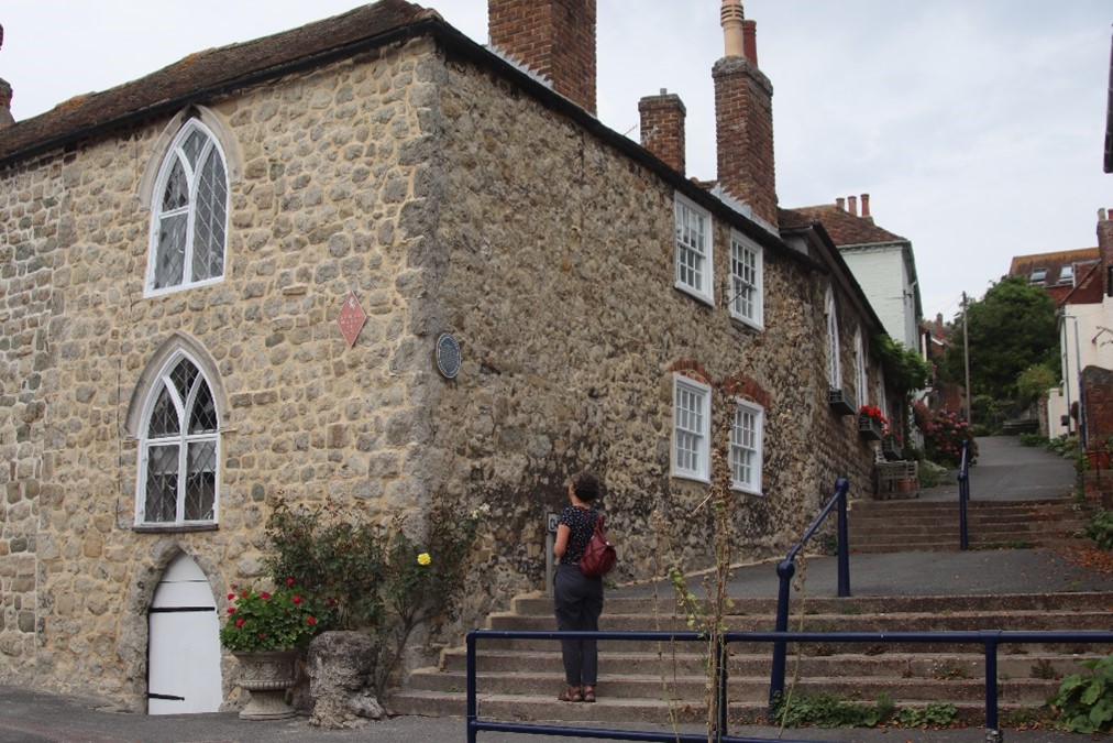
Figure 13 The Centuries the oldest building in Hythe & a former hospital
The Centuries has been there since the 13th Century & the family home of Hamo de Herthe a Benedictine monk & later Bishop of Rochester. Hamo founded a hospital on the site that later became the Hospital of Bartholomew & existed as a church residence in some form or other until 1949. Cut through the road opposite & you are on Hythe High Street. Now partially pedestrianised its quite a pleasant old town High Street. Most of the shops I remember from the High Street’s heyday have long gone including the old-fashioned Sainsbury with the counters all around the tiled walls, the evidence of the banks, jewellers, tailors & hardware stores are still there on the fronts of some of the buildings. The pubs of my youth are still there but most have seen pretty hard times.
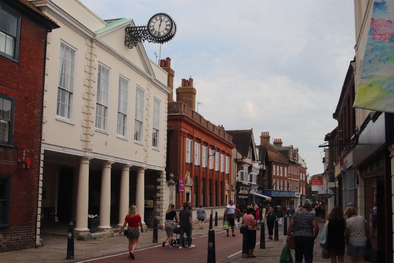
Figure 14 Hythe Guildhall & High Street
At the High Street you should turn right & then first left down Bank Street. Before the end of the street take the pedestrianised way & cross the road to the Royal Military Canal. If it’s a windy day for a more sheltered return walk then this may be a more pleasant alternative than walking into a bracing wind on the sea front.
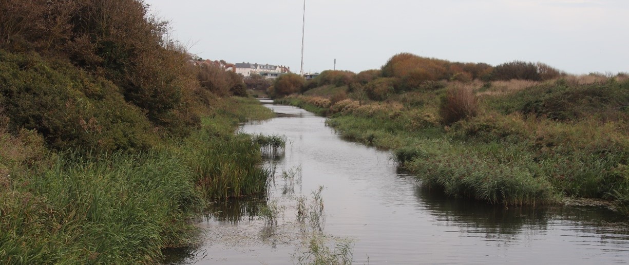
Figure 15 The Royal Military Canal approaching Seabrook
You can follow the Canal all the way back to Seabrook & pick up the Sea front there to return to Sandgate. Built as part of the coastal defences at the time of the Napoleonic wars the Canal follows the edge of the Romney Marsh & the base of the downs from Seabrook to Rye. National cycle route 2 follows the canal from Hythe into the middle of the Marsh & then takes you on gloriously empty (usually) roads around the villages & churches of the fifth continent.
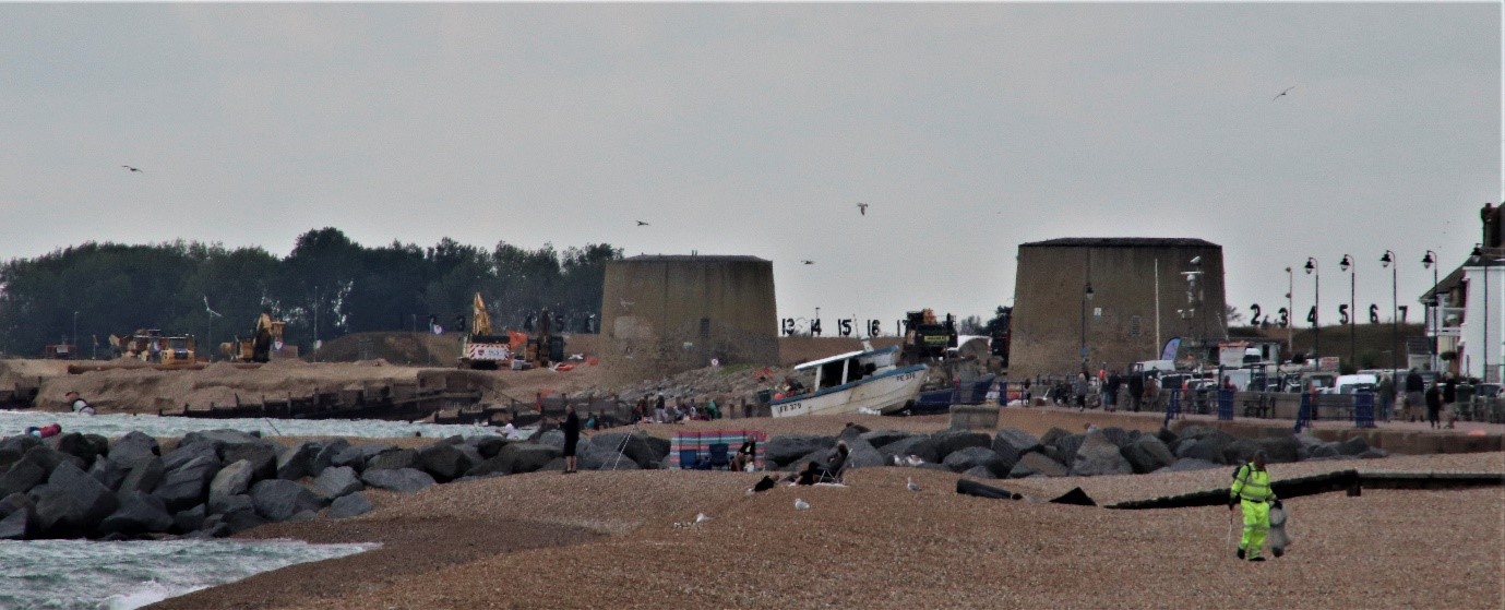
Figure 16 Hythe working beach, two martello towers & army rifle range
For the hardy souls who want the bracing walk along the sea front, and after all this is supposed to be a coastal walk then continue down Stade Street until just before Stade Street Garage on the right is Windmill Street. Follow this road to the end. If you time your walk right then you may wish to stop off at the Three Mariners a decent back street pub. Just beyond the pub there is an odd little triangle of land that is a community garden. Turn Left here towards the sea on St Leonards Road. Before you reach the sea cut down Range Road. Before reaching the new housing development turn left back towards the Sea. On the beach is Griggs – the fish mongers. You have to stop here & buy some really lovely fresh fish. They also have a little café at the front. If the suns out & it is warm this a good place to relax. Next to Griggs is a working fishing beach. Up until WW2 the beach in front of our cottage had its own boats working the local fishery. As you look down the coast you can see miles of undisturbed beach with the breakwaters that up until very recently went all along the coast. And behind that is the army range.
Now finally back on the coast you will normally be walking into the wind to get back to Sandgate. From the Stade Court Hotel onwards the promenade has a wonderful selection of older houses backing onto the beach. Once you reach the Imperial Hotel its now just a walk alongside the shingle beach with sea doing its thing, the views back up the hillside where you have walked & the prospect of a cosy rest when you finally reach Sandgate.
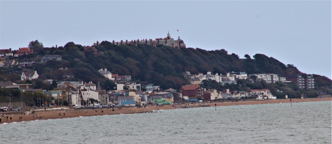
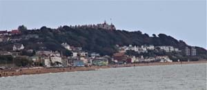
Figure 17 View from Hythe across the bay to The Little yellow Cottage & Sandgate. The Grand & Metropole above on the Leas.
